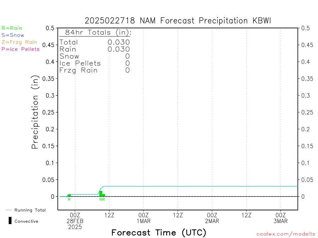
NCEP Model Time-Series (BUFR) Forecast Hourly Weather Data
current nam Precipitation for BALTIMORE/WASH INTL MD (KBWI)
Location: 39.18N 76.67W
Please note that the NCEP precip type scheme often misdiagnoses marginally sub-freezing snow-
supporting temperature profiles as sleet or rain. Please check the Temperature (Lower) image link to the left as well
to confirm the precipitation type.
JUMP TO A STATE/REGION:
USA:
   
AK
AL
AR
AZ
CA
CO
CT
DC
   
DE
FL
GA
HI
IA
ID
IN
IL
KS
   
KY
LA
MA
MD
ME
MI
MN
   
MO
MS
MT
NC
ND
NE
NH
NJ
   
NM
NV
NY
OH
OK
OR
PA
RI
   
SC
SD
TN
TX
UT
VA
VT
   
WA
WI
WV
WY
CANADA:
   
AB
MB
NB
NF
NS
ON
QB
YK
INTERNATIONAL:
    BELGIUM
    ENGLAND
    FRANCE
    JAPAN
    MEXICO
    SPAIN
OFFSHORE:
   BUOYS
nam stations available for VA
    KC27-NEAR HOT SPRIONGS, VA
    KCHO-CHARLOTTESVILLE
    KDCA-WASHINGTON/NATIONAL
    KIAD-WASHINGTON/DULLES
    KORF-NORFOLK INTL ARPT
    KRIC-RICHMOND/BYRD FIELD
    KROA-ROANOKE MUNICIPAL
    KWAL-WALLOPS ISLAND STN (AS
Jump to another current model:
   GFS
   NAM
   RUC
Jump to another nam run:
    current
    2013052100
    2013052018
    2013052012
    2013052006
HELP/DOCS:
    modelts@coolwx.com
If you find coolwx useful,
please consider donating.